Exploring Canadian Geography
Grade 9 De-streamed, following the Ontario curriculum.
- 5 units
- 31 lessons
- 252 practice questions
- 262 flashcards
- 3 simulators
Units
Geographic Thinking & Skills
The toolkit for the whole course: the four concepts of geographic thinking, the inquiry process, judging sources (including AI-generated ones), reading maps with latitude, longitude, scale, direction and contours, and the geospatial technologies and careers that use these skills.
Physical Geography of Canada
Canada's landform regions and the geological, glacial and climatic processes that shaped them; climate, ecozones and water; natural hazards and climate change; and how the land shapes Canadian life, identity and stewardship.
- 1Canada's Landform Regions
- 2Rock Cycle, Plate Tectonics and Glaciation
- 3Climate and Its Factors; Reading Climate GraphsInteractive
- 4Ecozones: Vegetation, Soils and Wildlife
- 5Water: Drainage Basins, Lakes, Rivers and Ocean Currents
- 6Natural Hazards and Disasters in Canada
- 7Climate Change in Canada: Consequences, Mitigation and AdaptationInteractive
- 8People and the Land: Livelihoods, Identity and Stewardship
Managing Canada's Resources & Industries
Canada's renewable, non-renewable and flow resources and where they are found; farming, forestry, fishing, mining and energy; knowledge-based industries, industrial location and trade; land tenure, Indigenous rights and economic reconciliation; and how to judge whether resource use is sustainable, right down to the products you use every day.
- 1Types of Resources and Where They Are Found
- 2Primary Industries: Farming, Forestry, Fishing and Mining
- 3Energy Resources and Clean Energy
- 4Economic Sectors, Knowledge-Based Industries and Careers
- 5Where Industries Locate, and Canada's Trade Connections
- 6Land Tenure, Indigenous Rights and Economic Reconciliation
- 7Sustainable Development and the Life of Everyday Products
Changing Populations
How Canada's population is counted and why it changes; population pyramids, aging and dependency; immigration and migration within Canada; where Canadians live and why; quality of life and well-being measured with real data; and the population issues, from housing to refugees, that Canada and the world face now.
- 1Measuring Population: Rates, Growth and the Census
- 2Population Pyramids, Aging and DependencyInteractive
- 3Immigration to Canada: Categories, Sources and Trends
- 4Internal Migration and Settlement Patterns
- 5Quality of Life and Well-Being: Indicators and Data
- 6Population Issues for Canada and the WorldInteractive
Liveable Communities
How land is used in Canadian communities and why; how nature, climate change, money, culture and politics shape planning; urban sprawl versus compact growth and the tools used to manage it; and how food, transportation and energy systems, housing, accessibility and culturally informed design make a community more or less sustainable and liveable.
Simulators
Simulators for every course →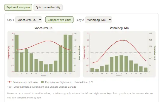
 CGC1W
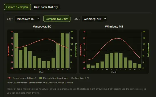
Draw real climate graphs for ten Canadian cities, work out the range, mean and total precipitation, and use LOWERN to explain why Vancouver and Winnipeg are so different.
 CGC1W
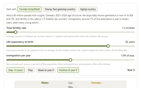
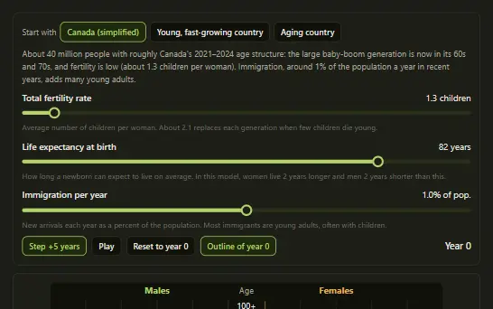
Change fertility, life expectancy and immigration, then watch a population pyramid age five years at a time as the median age and dependency ratio change.
 CGC1W
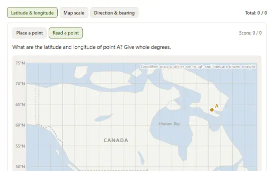
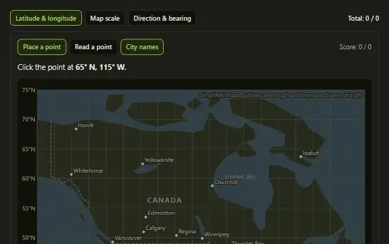
Practise latitude and longitude, map scale and compass bearings with instant feedback and a worked solution for every question.